The Tour des Fiz in the « clockwise » direction
From the Place Tobé car park (1020m -Village of Passy), head towards Plaine Joux (1352 m), taking the Nant Bordon footbridge as your preferred route (identical return journey).
From the Plaine Joux car park, head west towards the Chalets de Charbonnière (1407 m), where the winding ascent to the Platé dessert begins. The path crosses the last rocky bar and leads to a plateau, then to the Chalets de Platé (2032 m), where the refuge of the same name is located.
Further upstream, the path heads towards the Col de la Portette (2354 m). A path allows you to take a short diversion to reach the Passage du Dérochoir (2225 m). Descend through the centre of the wide combe to the Chalets and refuge de Sales (1877 m).
Continue down towards Six-Fer-à-Cheval, admiring the many waterfalls...
At the junction, you can descend to the Lignon (1180 m) and Fardelay (1020 m) car parks and then return to the Grenairon (1950 m) or Fonts (1380 m) refuges.
Alternatively, follow the path up to the Collet d'Anterne (1796 m) and the Chalets d'Anterne (1810 m) where the Alfred Wills hut is located.
Head towards the Col d'Anterne (2257 m), skirting the beautiful Lac d'Anterne (2063 m) at the foot of the limestone cliffs.
Shortly before the lake, join the route from the Fonts and Grenairon refuges via the Petit Col d'Anterne (2038 m).
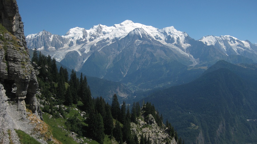
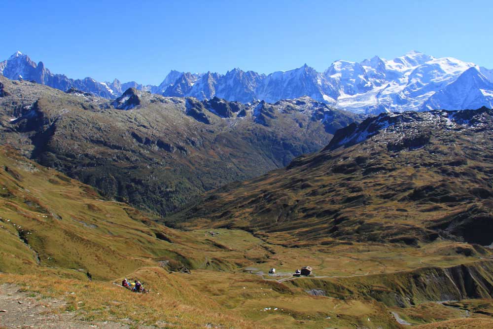
From the Col d'Anterne, there is a vast view of the Mont Blanc massif.
Descend to the Moëde Anterne refuge (2002 m).
There are several options for reaching the Châtelet d'Ayères refuge (1415 m), Lac Vert (1266 m) and finally Plaine Joux (1352 m):
- Via the dirt road and its shortcuts via the Chalets d'Ayères des Pièrrières (1637 m) and Barmus (1606 m) (possibility of a chairlift descent).
- By the Argentières path (tricky route) via Chalets du Souay (1569 m) and Le Gouet (1429 m).
- Via Lac de Pormenaz (1950 m), and a steeper descent (known as the Chorde descent - tricky sections) via Chalets du Souay.

Book your route
The Tour des Fiz in the « anti-clockwise » direction
From the Place Tobé car park (1020m -Village of Passy), head for Plaine Joux (1352 m), taking the Nant Bordon footbridge as your preferred route (same route there and back).
From the Plaine Joux car park, head east towards Lac Vert (1266 m) and the Châtelet d'Ayères refuge (1415 m).
Continue uphill to the Moëde Anterne refuge (2002 m).
There are several options:
- Via the carriage path and its shortcuts via the Chalets d'Ayères des Pièrrières (1637 m).
- By the Argentières path (tricky section) via Le Gouet (1429 m) and Chalets du Souay (1569 m).
- Via Lac de Pormenaz (1950 m), and a steeper ascent (known as La Chorde - tricky sections) via Chalets du Souay.
After a few obvious switchbacks, climb to the Col d'Anterne (2257 m), with its vast view of the Mont Blanc massif.
Descend to the beautiful Lac d'Anterne (2063 m), at the foot of the limestone cliffs.
Shortly after the lake, join the route to the Fonts (1380 m) and Grenairon (1950 m) refuges via the Petit Col d'Anterne (2038 m).
Continue downhill to the Chalets d'Anterne (1810 m) where the Alfred Wills refuge is located.
Continue on to the Collet d'Anterne (1796 m), then start a steep descent towards the Lignon (1180 m) and Fardelay (1020 m) car parks.
At the junction, turn left along the path with its many waterfalls to the Chalets and Refuge de Sales (1877 m).
Through a wide valley, the path heads towards the Col de la Portette (2354 m). A path allows you to take a short diversion to reach the Passage du Dérochoir (2225 m).
Descend to the Chalets de Platé (2032 m), visible below and home to the refuge of the same name.
After crossing the flat, then the rocky bar along a path cut into the rock, wind down to the Chalets de Charbonnière (1407 m).
Cross back east towards Plaine Joux (1352 m).

Book your route
Access:
 Tour de Fiz - Car access and parking
Motorway A40 E 5 Annecy Chamonix axis. Take exit 21 ‘Saint-Gervais-les-Bains, Passy, Le Fayet’. At the roundabout, take the 3rd exit, continue on D339 towards : ‘Chedde, Passy, Plateau d'Assy’. Take the D43, cross the Plateau d'Assy. Go to the Plaine Joux car park.
This route can also be taken from Sixt-Fer-à-Cheval, on the other side of the Haut-Giffre massif. Access by car and parking:
Motorway A40 E 5 Annecy Chamonix route. Exit 18 ‘Scionzier-Cluses’. Reach Sixt-Fer-à-Cheval via Châtillon sur Cluses and Samoëns. Then take the D29 towards Salvagny, as far as the Parking du Lignon.
 Tour de Fiz - Public transport access
The Tour de Fiz can be reached by bus from Sallanches SNCF station and the following stops, on the Y85 / Sallanches / Passy Plaine Joux line.

